For Passover, an interactive map brings the haggadah down to earth
Alon Gildoni and Ron Milo turned a Passover question into an interactive tool that traces the Exodus story across real-world locations
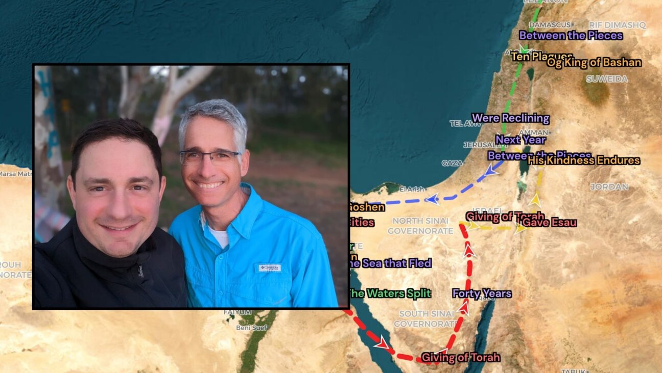
Alon Gildoni and Ron Milo turned a Passover question into an interactive tool that traces the Exodus story across real-world locations

WASHINGTON (JTA) — Official U.S. maps now include the Golan Heights as part of Israel. Jason Greenblatt, the top White House Middle East peace negotiator, posted a map Tuesday on his Twitter feed. “Welcome to the newest addition of our international maps system after @POTUS issued a proclamation recognizing Israeli sovereignty over the Golan Heights,”…

While the casual New York deli may be on the decline, a new day of national Jewish delis has dawned. Jewish delis are going international, with new locations opening in places as unusual as Denver, Colorado and Tokyo, Japan. Here’s a roundup of all the new delis that opened in 2018 that are worth paying…
A White House video designed to promote the first trip abroad by President Trump seemingly portrayed a shocking change in American policy and the Trump administration’s beliefs. But it was pulled almost immediately. The video was intended to promote the trip to four countries. A slide in the video showed a map of Israel with…

MSNBC apologized for using “not factually accurate” maps in a segment discussing the violence that has erupted across Israel in recent weeks. “MSNBC Live” host Kate Snow acknowledged Monday that her show displayed maps describing present-day Israel as a Palestinian state in 1946, when the area was under British mandate rule. The series of maps…
Responding to parents who complained about the distribution at public schools of a map which labeled Israel as “Palestine,” the City of Paris said it was the result of “a simple production error.” The city’s media department gave the explanation in a statement it published Friday about the distribution earlier this year to elementary school…

(JTA) — Before the HarperCollins Middle East atlas story is deleted from email inboxes, it pays to spend another moment ruminating on the damage caused by companies that ought to know better. On its website, HarperCollins bills itself as “one of the world’s leading English-language publishers.” It has a storied brand and a list of top-notch…
The HarperCollins publishing house apologized for omitted Israel from maps in atlases that it sells to English-speaking schools in the Middle East. “HarperCollins regrets the omission of the name Israel from their Collins Middle East Atlas. This product has now been removed from sale in all territories and all remaining stock will be pulped. HarperCollins…


100% of profits support our journalism